Sunrise on the wheat farm. Grant County WA

Bright and early is the name of the game. I have always been an early bird. Not knowing what was on the road ahead compelled me to get going...but not until after breakfast at the local diner.
Inside there were two tables of "old friends" whom I imagine were perhaps bachelor farmers getting ready for a days work drinking medium strength diner coffee. They were discussing, amongst other things, who was going to wear what to that afternoons funeral. It felt like they spent most mornings here.
North on Hwy 21, a bee line to Republic. The sunrise was lovely and the rolling hills persisted north through the county.

Adams county gives way to Lincoln county and more wheat fields. Then BOOM, back into cuts of Channels and the effects of the Bretz Floods. It made coming over a rise at 60 mph quite exciting. Slowly the area continue through more dips and rises, less agriculture fields. A signpost announces ... slow, curves ahead next 4 miles 15 mph. I remembered seeing a convoluted bit of road on the map and here it was. A thrilling descent with hairpin turns down through a canyon to the shores of Lake Roosevelt (behind Grand Coulee Dam) to the Ferry crossing that takes you Ferry County.
The ferry crossing was free. It was a sweet little event. The Martha S.. holds about 6 to 9 vehicles. The lone deck hand carefully balances the load and a chock of wood goes behind each vehicles wheel. The wood was polished smooth with years of wear and weathering. I doubt it would stop a baby carriage from rolling

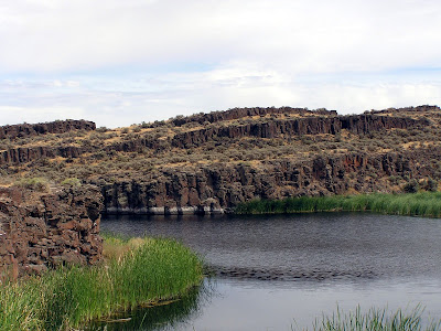
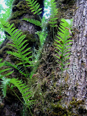
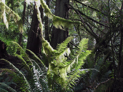
The motor home had the front and center. They were the first off and the bow of the ferry noticeably popped up as they did. Sweet! I was the last off. Immediately we are in the Colville Reservation and the geologic area known as the Okanogan lobe. You can see in the canyon picture above the sudden switch of geology from flat rolling hills to imposing mountains ( and trees!!). The Okanogan lobe was one of the areas that turned the Bretz floods southward. The Grand Coulee was dug by the floods, giving a natural spot to place the dam and the steep walls created the imposing Lake Roosevelt. As I drove north through the deep canyons surrounded by trees, I felt a loss for the open rolling vistas. There was a lot of evidence of forest fires which move through this region every summer. It is easy to see how the canyons make fighting fires difficult. The population density is tiny and Republic, population 1000 is the county seat. It was Fair Weekend, as it was in most of the counties I visited on this trip. A miscalculation on my part, making finding a motel room a particular challenge. I was lucky to find a room in Ritzville.
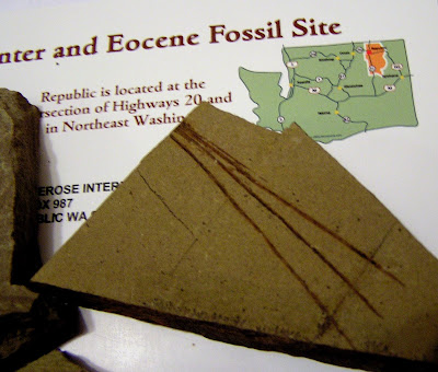
Republic seems like a nice little town. A former gold mining concern, it appears to support a fair number of nice shops and restaurants that seem to have a slight feel of 60s counter culture. The Stonerose Center is a huge attraction. There were several families from all over. Rock hounding is certainly popular and eastern / central Washington as well as eastern Oregon are meccas for all types of geology experiences.
Armed with a hammer and chisel and a quick lesson in technique I walked to the site 2 blocks away. It was like potato chips. Hard fought for potato chips but you just cannot stop. Several regulars mentioned that the digging was not particularly good that day. The stones were not breaking off well and there was a need to bring in some cleaning to clear off the reject rock to improve access to the fresh rock wall. There was one area roped off which was currently undergoing a researchers investigation.
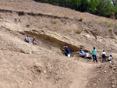
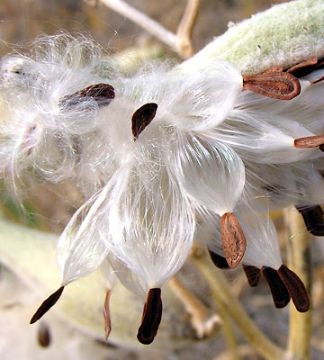
The boys on the right are at my spot. I showed them the items I had found and they eagerly went to work. The woman and her daughter, on the left, were real pros. Mom was a surgical nurse and was making use of a bone chisel that had long outlived its surgical suite use. I was the plodder novice of this bunch. I am please with my discoveries. Without big tools, like long flat chisels for excavating large rock mass, you are left with palm size pieces to pry out. Any find is a lucky strike. My rocks tempt me with a second layer. I could try to uncover a bonus prize, but at the risk of crumbling the one I have.
Four Needle Pine, Pinus tetrafolia
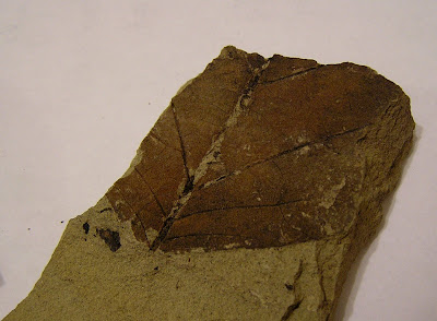
A Witch-hazel family leaf, Langeria magnifica (extinct genus)
Dawn Redwood, Metasequoia

My Dawn Redwood broke during the final cut, but I was able to take my finds back to the center where a staff member told me what I found and did some repair on the split piece. This was, hands down, one of the best $9 experiences I ever had.
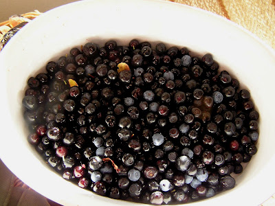
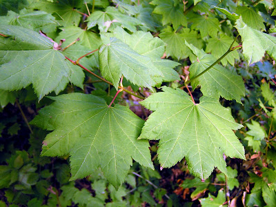
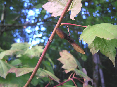
My next destination was Twisp with the intent to stay the night and drive up to a short hike at Harts Pass off Highway 20. The hike had a long drive in to the 7000 ft elevation. Along the road to the trail there are fossilized snails to be found. This area was once under the sea. As I neared Twisp the weather was changing and sketchy radio weather reports said the rain would continue through Sunday. I could not find a motel with a vacancy sign so decided that I best push off home. I decided Hwy 2 was a best choice. Going south from Chelan, it was interesting to note the contrast between the either side of the Columbia River . On the west, imposing rock face walls come down from mountains. On the east side of the river are soft rolling farm orchard and vineyard uplands hills. Further evidence of the flood waters effects. A plus to this route was stopping at one of the many fruit stands. While the one I chose did not have any hard ciders, they did have some novel apple varieties that will lend themselves to an awesome pie.
Arriving in western Washington to rain, which persists today, the weather report mentioned that snow was a possible with the freezing level dropping to 6000 feet and a possibility of one foot of snow. I knew I had made the correct choice. I doubt I will be able to get up to Harts Pass this year. Highway 20 is typically one of the first roads closed for snow and one of the last to open. My wildflower hike books promises that these are some of the best wildflower areas in the state.
I look forward to exploring next year. I will look for Professor Kruckbergs snails and return to Republic for some compelling digging.


 The town of Mazama is at the head of the Methow Valley. Coming down I was struck by the very sudden change to dry side ecology. Usually on I-90 you have a gradual transition, here is was almost like going from one room to another.
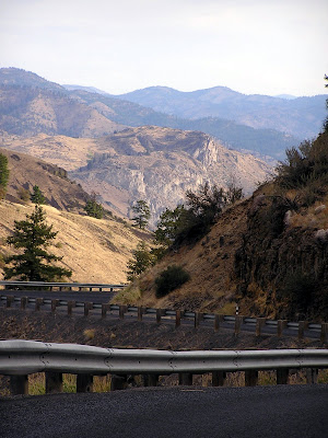
 I had thought the road pretty narrow and steep up to here. BUT NOW we need a warning sign. Whats ahead???
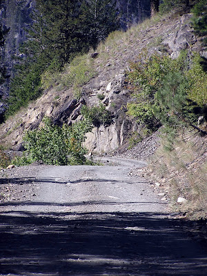 That does not look so bad, who are they kidding? But then they throw in distracting views..
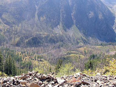 I stop and take a picture and start ahead only to see this at the next bend
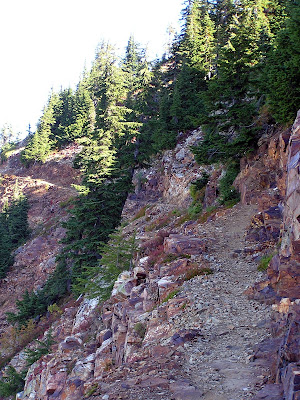
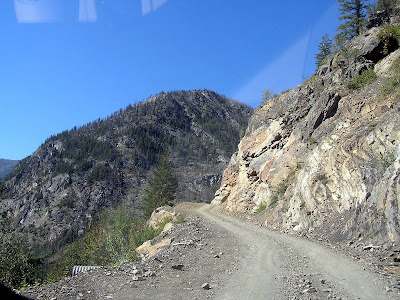 OK THIS is a serious road. Blind corners, drop off edges. It went on more than a 1/2 mile. Most of the way there were no pull off, and most of the pull offs were about the size of a Beetle. Thankfully going up and down I encountered no situation where I had a standoff with another vehicle.
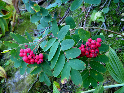
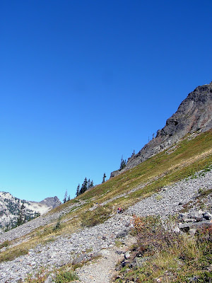
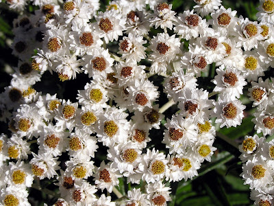
 The access road up to the top of Slate Peak is an easy stroll. It is just a half mile, not much as a hike goes. But the main attraction is for the view and for the wildflowers in season. Rare high elevation plants. The main hike along the foot of this ridge is 7 miles round trip so that makes the distance of the drive reasonable. There are ample camping and motel opportunities so it is going on my list for next year. Up here at 7100 ft ( 7480 at the top) you get a great view of many fine mountains
 Crater Basin (left) and Paul Bunyan's Stump (far right)