About Me

My photo
Just a meandering soul sharing my backyard. Visit my Flickr page too! www.flickr.com/photos/meanderingwa/

Sunday, June 30, 2013

Like Here Only Different ~ Day Seven Reflections

Seven remarkable days done.

FALLS: ZERO!!  I cannot believe my good fortune.  Not a single fall the whole way.  Climbing stiles and fence crossings can be an adventure.  High mountain trails paved in rocks, thank you walking poles.

BLISTERS : two.  As expected, on the fourth toe of both feet.  Wish I had pre-wrapped.

Highlight :  The goodness and kindness of ever person I have met on the way.  Hospitality next to none.  Anyone wishing to go into the business of B&B should come here.

Lowlight:  Going off course on day three and the difficult recovery that afternoon.  Three glasses of water and 6 teaspoons of sugar.

Eager to see the picture :  Shap Abbey

Wishes:  A pair of closed walking shoes for cement.  I brought Keen sandals, not suitable for wet soggy bits.  Good all-purpose trail runners would be welcome.

More energy at the end of the day to explore the village I am in.

Lesson learned:
I now enter GPS waypoints listed on the days map... A safety and aid.
Talcum powder
Grab apples at the shop when you see them
Not all Scrumpy cider is "Old Rosey". Some is old cat piss
Always bring an extra top for when you want to be clean.  One is not enough.


Like Here Only Different ~ Day 8 Orton to Kirkby Stephen

Orton to Kirkby Stephen 11 miles / 18Km 5 hours ~  Orton - Orton Scar - Sunbiggin  Tarn - Severals Village Settlement - Kirkby Stephen  Tonight I stay at Jolly Farmers Guest house  www.thejollyfarmers.co.uk

I have left the Lakes District NP and we are making our way along level ground.  While the distance is short, the trail is filled with many things to stop and wonder at.  Today I managed the distance in in 6 hours with a tailwind.

Just 1 mile east of Orton and fine stone circle can be seen from the trail.  Like some of the other circles, better seen from elevation.

Sunbiggin Tarn, an area of marshy ground with a small lake is an important bird sanctuary.  The early morning is always best for birding.  Unfortunately, today was not birdy.  A few gulls here and there but for the most part, no one about.  I did however find some wonderful bog loving purple orchids.


Severals Village settlement is a site currently under study.  Many say it may be one of the most important pre-historic sites in Britain. The site is unexcavated but modern technology can do a fair amount of investigation these days. .

Near are the Giants Graves, a series of long narrow mounds thought to be for penning rabbits.

This viaduct seemed to pop up out of nowhere.  Right around the bend from Several Village.


Kirkby Stephen ( say Kirby Steven) is the 2nd biggest town on route Population about 2000.  Kirkby Stephen is the spiritual heart of the C2C trail.  In 2010 the town won the Cumbria in Bloom Gold medal for its home gardens. 

There have been markets in town since 1361 and the market square floor has an old bull baiting area which was active into the early 1800's


Beautiful stone benches.


We are, for the most part, half way done. Here are all the luxuries of a town, a bank machine,  supermarket and an Indian (curry-house) restaurant.  There is an outdoor shop, the guidebooks points out, handy for restocking blister kits.

 A quirky signpost on the edge of town still lists distance in furlongs ( 8 furlongs = 1 mile)


This was the day for wind.  Dark clouds just racing past.  I popped on the rain gear from the start and the best that can be said is that it cuts down on the wind chill.

This is still sheep country but today I also got close and personal wit Aberdeen Angus cows and their little ones.

And their pies.

Anyone adverse to animals and their droppings should NOT
undertake this trip.

I could not get these little ones to give me the time of day.


No curry house today.  I got to town by 230 and spent some time getting lunch snacks then to a little bistro for late lunch.  Cold crab and a salad with veg and fruit.  Plus a big bottle of cider.

Happy me.  Late dinner will be cheese , apple and puffs crackers.


Saturday, June 29, 2013

Like Here Only Different ~ Day 7 Bampton Grange to Orton

Bampton Grange to Orton 12 miles 19.5Km 5 hours   Bampton Grange , Shap Abbey, Shap , Oddendale, Robin Hood's Grave.  Tonight I stay at Scar Side Farm www.scarsidefarm.com  up the road from Orton.

This is an easy day of fairly unremarkable terrain but some choices to make on the map.  Shap Abbey will be a highlight.  The last abbey founded in England in 1199. Built by the French Premonstratensian order ( the White Canons)  founded by St Norbert in Northern France.  This was the last abbey to be dissolved by Henry VIII in 1540.  After the abbey was pillaged, locals used carved stonework from the building in their constructions.  The Shap Market Hall was built from abbey stone and many of the stone walls in the area contain verified stones.

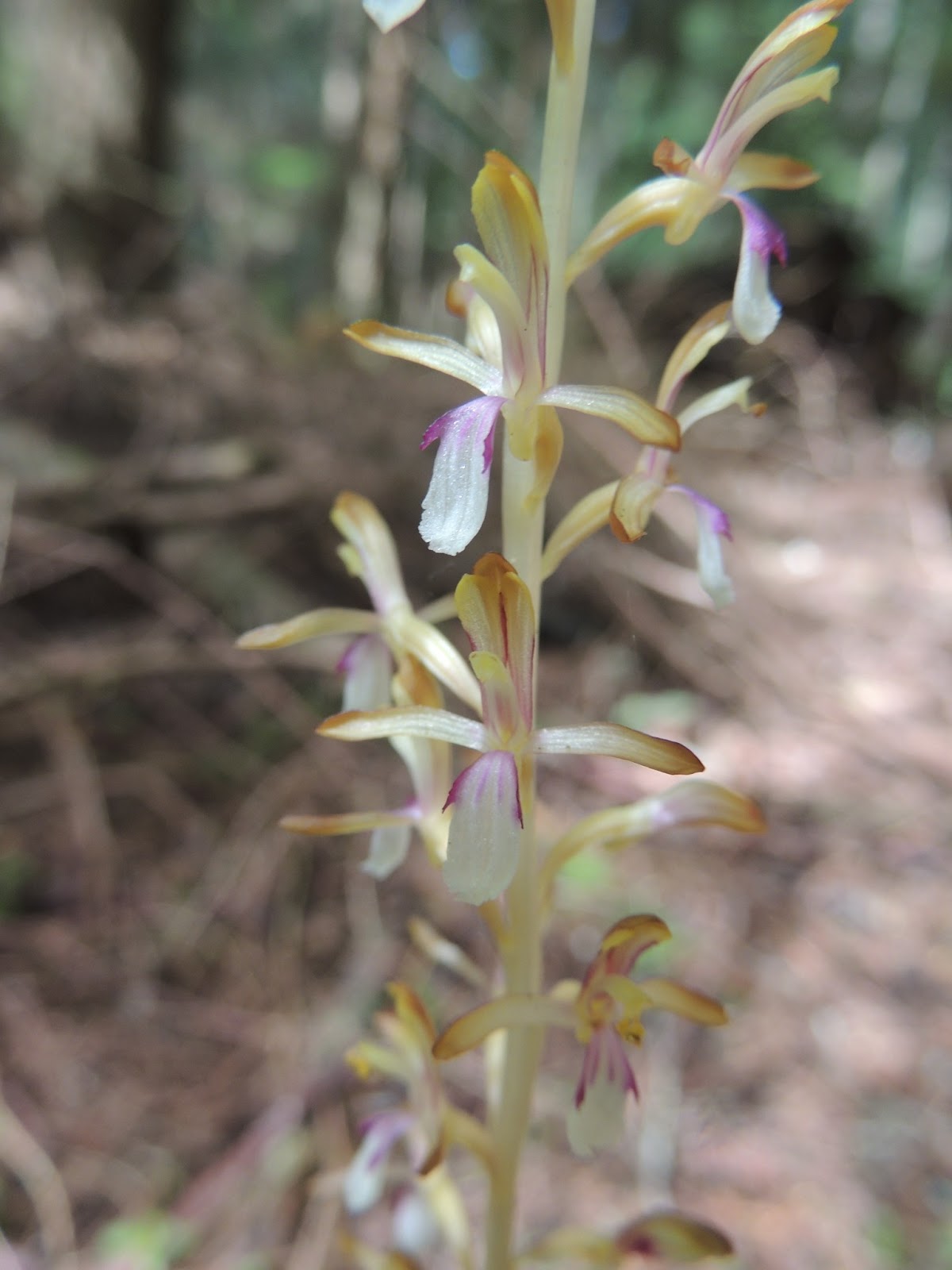
The walled village of  Oddendale contains two ancient stone circles.  You can find them on Google maps, but finding them from the ground is said to be very challenging.  Robin Hoods Grave is a large cairn with certainly no Merry Men buried within.

The highlight of Orton is the church dating to 1293 and a set of pillories (stocks). A block down the road Kennedy's Chocolate Shop.  For anyone conquering the previous 5 days, a chocolate pig-out is earned.  It is likely to be great incentive to make sure I am in town before closing time.

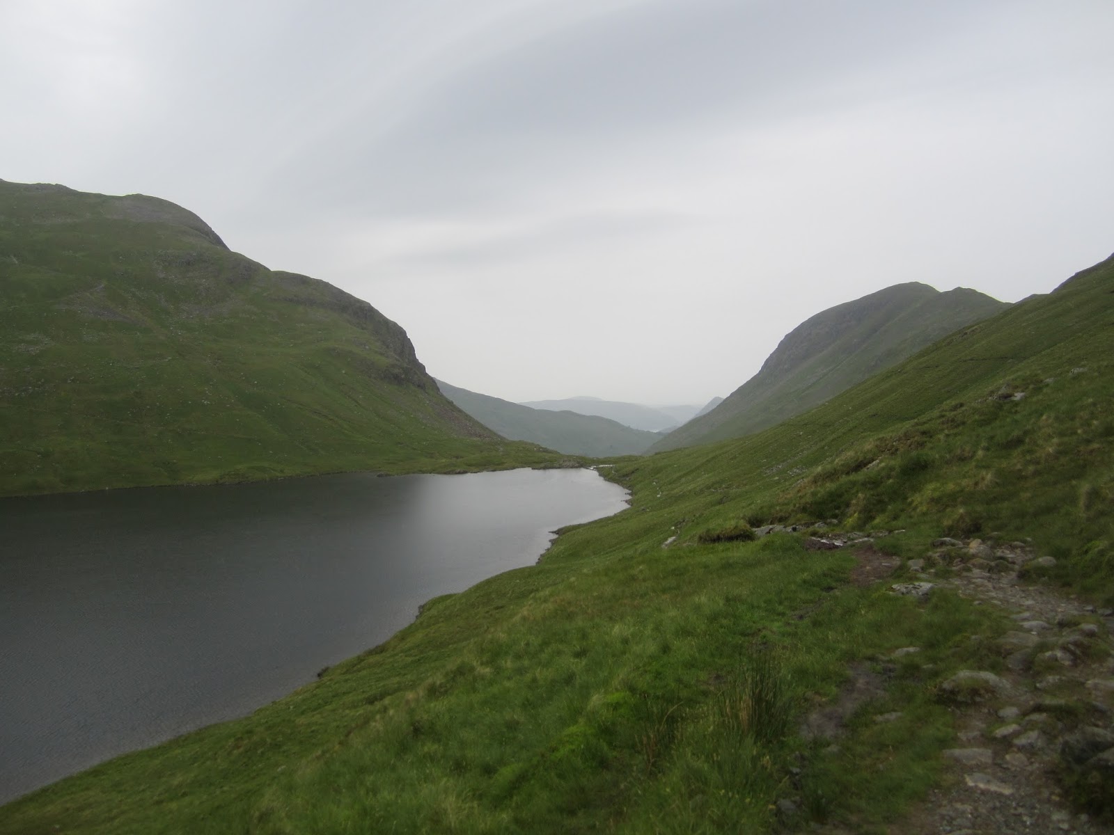
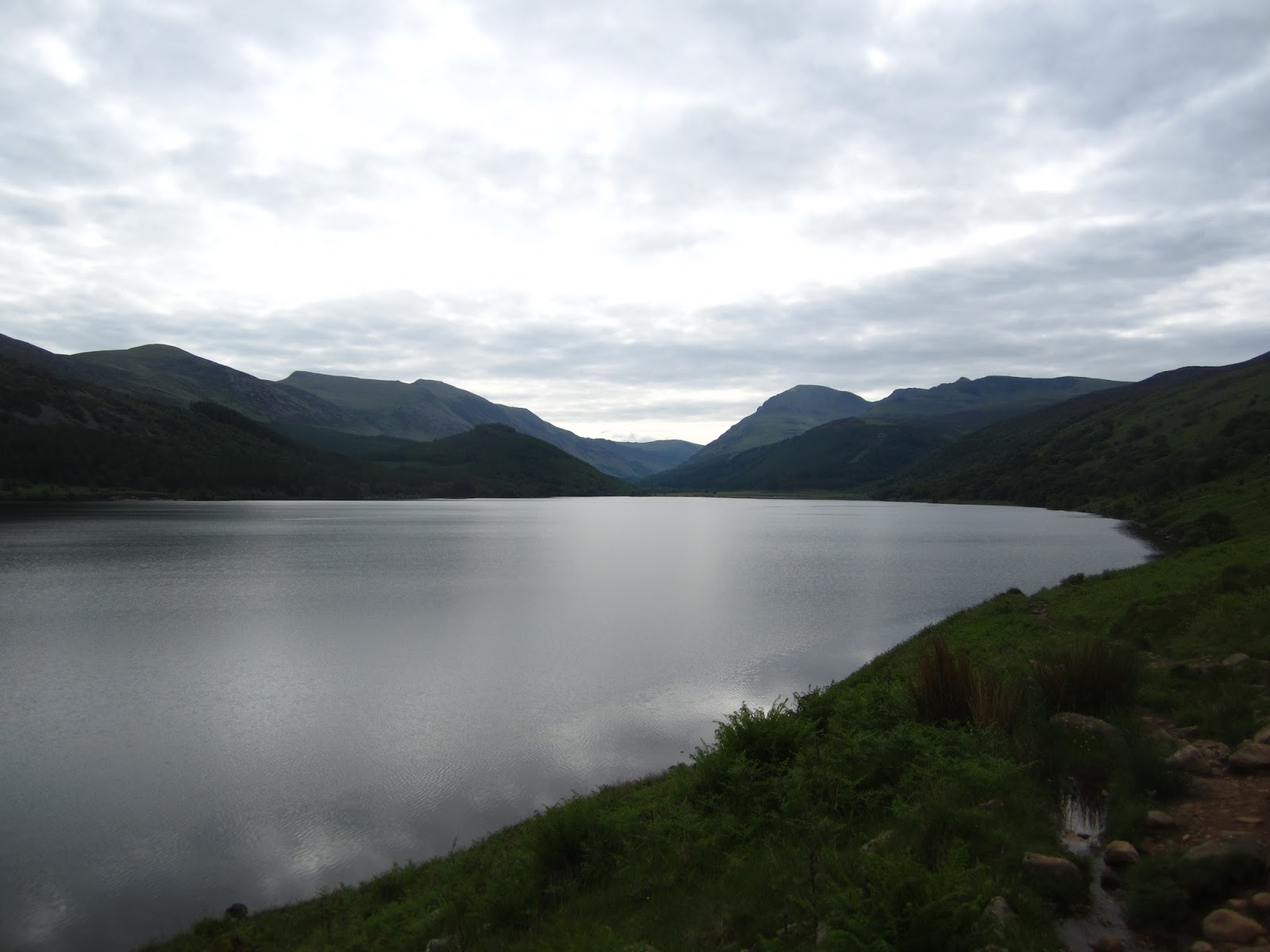
I have left the Lakes District National Park and head right into North York NP for more ups and downs.

What a fine day this was.  The distance from yesterday was only half, about 10 miles.  I spent 6 hours walking, though.  Yesterdays distance of about 18 miles was covered in about 6 1/2.  Today was the day for slow walking.  The way went through farms and fields.  It is warm enough, but not too warm.  Slightly sunny, mostly cloudy, a bit windy.  I thought for sure it would start raining and even stopped to put on my coat.  It never happened, so was the perfect day.

There were many fine distractions.

Pretty farms buildings


Happy farm animals..


How could I not stop and try to make friends.


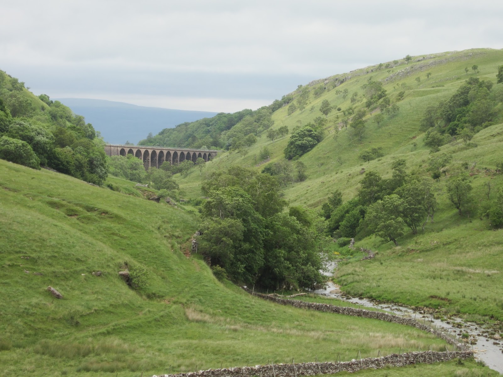
Shap Abbey was a beautiful sight.  So situated within the landscape that when I got upland of it, it could not be seen.  There was a farmer who clearly has permission to use the land and 2 tidy, modern free-range chicken houses looked sharply out of place near the ancient walls.  As you neared the abbey, there was a perfect river flowing under a perfect bridge.  I know that one of the pictures I took will turn out to be  favorite keeper.


It was here I encountered the first "trail angel".  Trail angels are people who provide refreshments, usually unexpected.  A large plastic bin filled with crisps (potato chips) fruit and granola bars, and drinks---including beer and cider.  Honor system in play, I pitched in 3 pounds for chips a bar and a cider.


Shaps' single main street provided a stop for a few supplies; apple for lunch, some lip balm and some very vital talcum powder.

Leaving Snap we quickly climbed a fell and were away from charming farms and sweet animals.  The fells are open range country and the plants are wild grasses and bracken.  The lush pastures of mix grass and timothy would make my horsey friends sigh.  Walking through one spot , all I could think of is how I wished I had a horse at that moment so I could have a glorious gallop up over a hill.

Those I am talking to right now understand.

This is galloping country.

Through a quarry where I spotted some interesting shorebirds to be puzzled over on the computer when I get home.  I brought my binoculars, but they are so heavy to wear every day that I will have to save these birds for when I get home and can view them on the big screen.

I didn't enter Oddendale but did walk out to the stone circle.  I could see where the circle was on the approach , but once you got into it, poof it was gone.  Very unlike yesterdays circle.  You can see this circle on Google maps.  Give it a try...Oddendale should get you near.  I bet you will spot the trail, too.  Happy hunting.

The land on the fell was built on limestone.  It erupts from the ground looking like long planks of Swiss Cheese.  Time and weather wears it away.  Who knows, thousands of years from now they could be tall hoodoos.  Our map showed two trees as a distant reference point.  When I got there, the trees were surrounded by this limestone.

I zipped through Robin Hoods Grave, a odd area of a deep area that looks like it had sunk and rocks fell in.

Right before getting to Scar  Side Farm, I had to stop while crossing a farmers land.  He and his wife were rounding up a small herd of sheep using an ATV and a bit of shouting and hand waving.  It was a fun diversion (and foot rest).  Darn me I didn't think of getting pictures, just enjoyed the entertainment.

Settled is as the only guest of the night.  I walked into town , about 1 mile.  It was a vital priority to visit the chocolate shop.  I was way early for dinner, so enjoyed a pint of cider and chatted with a couple from Australia.  We all pitched in to help another couple solve a crossword puzzle.  Chicken Balti for dinner.  Ahhh, spices.

For dessert

A SOAK IN A REAL BATHTUB!

Well,OK, I also have a chocolate caramel bar from Kennedy's.

Friday, June 28, 2013

Like Here Only Different ~ Day 6 Patterdale to Bampton Grange

Patterdale to Bampton Grange 14 miles / 22Km 6hours ~  Patterdale - Kidsty Pike - Hawswater Reservoir - Burnbanks,  Staying at Crown and Mitre Hotel www.crownandmitre.com 

The day is rated the most tough of the walk.  Starting right up from 500 feet to 2558 feet in 5 miles with two 1000 in 1 climbs, Kidsty Pike is the highest point on the walk.  Once up on Kidsty Pike, you go right back down to slightly below 1000 feet in 1 mile; a 1500 foot descent.

The guidebooks also mentions many boggy places.  I know my boots are waterproof but still, I hate boggy ground.

It is here were I start using all the supplemental maps provided by Sherpa Expeditions.  A bad weather route follows Ullswater circuiting the Kidsty Pike and even gives two options one low on the water and the other cutting upland.  I also need my extra maps as my hotel is not on the regular route.  It is said a visit to Ullswater inspired Wordsworth to write "I Wandered Lonely as a Cloud"


Today's weather was not favoring a single, cautious walker.  I know my companion of the last few day was going to do the route described above.  I opted to be conservative and take the bad weather route suggested by Sherpa.

It was an excellent choice.  I studied the maps and came to the conclusion that today's walk is probably 15 to 18 miles total.

My feet certainly feel it.  The trail walked the south bank of Ullswater to the halfway ferry dock, about 6 miles.  I then walked up and over Askham Fell about 8 more miles.  Finally down lanes and roads into Bapton Grange.

Being along the lake and in woods I got to hear a lot of songbirds.  I was able to spot several types of finch, a few of the tits (chickadees) and one of the medium sized woodpeckers which I only remember the German name , something like Mittlespeckt.

Over the fell I was into country I have not yet experienced.  Wide rolling tracks of grass and Bracken fern.  Sheep pop up out of nowhere.  For navigation I have three OS maps, which are what many hikers use for long trips.  My maps told me that I would stay on the obvious track until I came to "The Cockpit"

And there it was, faster than I expected.  The open ground is easy to stride across...none of this rocky, wobbly stepping.

What is The Cockpit?  It is an ancient stone circle,my first. The path along here was also part of a Roman Road.


More fun birds to see, arguing Raven, fighting Pied Wagtails and most unexpectedly, a Curlew.

I came down into the village via beautiful sheepfolds and small back lanes.


I had about three miles to go when the Sherpa Van zipped past me.  I felt a little deflated by then forced myself to push on.

As usual, a shower, a tea with cookies ( gingerbread from Grasmere) and a review of foot condition.  I had to book a table for dinner as the young man said, "It's Friday,we get busy.

It is Friday, I cannot believe I have come so far.

As I rest upon my bed, the sun had come out and the beautiful garden of the home next door has quite a lively bird population.

We are out of the mountains and distances will go faster, but not always easier.  This may become the time for longer days and and more attention to maps as to rove between one sheep farm to the next cattle farm...

With the occasional ruined historic site thrown in.

Thursday, June 27, 2013

Like Here Only Different ~ Day 5 Grasmere to Patterdale

7.5 miles / 12 Km 5 hours for standard route.  Add 2 miles and 2 hours for ~ Helvellyn.  Add 1 1/2 hour for St Sunday Craig. 
Grasmere - Grisdale Tarn
> Option 1  Helvellyn and Striding Edge ( Dixon Memorial) 
>Option 2 St Sunday Craig
>Option 3 Valley floor, multiple streams - Elmhow Plantation
all meet and into Patterdale. 
Tonight I stay am at Grisedale Lodge www.grisdalelodge.co.uk  and dinner is at the White Lion Pub.  www.patterdale.org/Whitelion.htm

A short but classic day.  Helvellyn is the third highest peak in England at 3118 feet.  It is a steady hike up from Grasmere to Grisdale Tarn where a decision must be made;  Helvellyn tough but a great highlight, St Sunday Craig, at 2756 a fine climb with kinder gain and descent.  The third route for those weary of leg or for when the weather is foul is and long gentle 6 mile valley floor descent to Patterdale. 

Helvellyn is quickly followed by Striding Edge.  Open knife-edge ridgeline walk that is thrilling for its views.  The guide book says Striding Edge can be walked in 20 minutes but to allow 1 hour for busy times where the narrow trail requires pulling aside and waiting for others coming from the opposite direction.  It is, perhaps, best tackled early in the day.  All the way up here is a memorial to Robert Dixon, who was killed in 1858 while following his fox hounds during a hunt.  That is tough sport in a tough country.  This is the place I want to be.  If it is a fine clear day, I will know it is the highlight of the trip.

St Sunday Craig is said to hold better views and fewer thrills.  The guide book describes it as a "steady plod" and far less strenuous than Helvellyn.  In recent weeks I have walked a route that makesj the steady 1000ft/mile climb (and even sharper descent) and feel OK for Helvellyn if the weather is OK.  The guide book says winds on St Sunday and be quite fierce, but the footing is better.


Well ,that is the tour book rundown.  The reality is that the day is drizzly and while I am feeling a bit better, I am in no shape for the extra miles and elevation.  I chose the valley route and it was awesomely wonderful.


The hills here remind me a bit of the scarred basalt ridges you see from Yakima north into the Okanagen However the are covered in green and dotted with sheep.


Sheep.  Funny things.  I asked one of my fellow travelers about how they keep control of the animals in what is open range.  He said ,as a rule the sheep had been living in this valley for so many generations, they simply don't stray.  Looking up these high hills, really we are in glacier carved canyon / valley, you can see stone walls running down the hillsides.  What a tough breed of people created all this.

With their bare hands.


This is Ruthwaite Lodge.  Stone built hut used for search and rescue.  We are at the backside of Nethermost and Dollywaggon Pike.  I hope you can see the detail of the waterfalls behind the building.

On the way up Tongue Gill there were local NP workers and volunteers doing work on the stones of the stair climb route.  I made sure to thank them for their effort.

I opined to one NP staffer that a least marker is really needed in the place we went astray yesterday.

He politely smiled and said "Yes"

Sort of as if he had heard it before.

At  dinner tonight and ran into a gent who started day one with me.  Tomorrow is his last day and it sounds like he will be trying the high mountain route.  Weather does not favor that for yours truly, so I am going to use the alternate route suggested by Sherpa.  I sat down with the maps and some info here at the hotel.  I found that there is an option of taking a boat part way up the lake, saving seven miles.


Wednesday, June 26, 2013

Like Here, Only Different ~ Day 4 Borrowdale to Grasmere

8.5 miles / 13.5 Km 5 hours Gain 1850 feet (750m) ~ Borrowdale -  Greenup Edge -  Pike of Carrs - Helm Craig - Grasmere.  Tonight I stay at Glenthorne Country House and Quaker Conference Center www.glenthorne.org.  Glenthorne has tea and cakes to welcome you ( what is not to love???) and communal dinner at 7pm The first ATM on route

A short walk today but it comes with a stunning gain of 1500 feet between mile 2.5 and mile 4.  You also have to get back down to 250 ft level but they give you a few extra miles with a 1000 foot drop in the last mile.  This is a toe cruncher.

We are descending into Lakeland Poets territory.   Wordsworth spent nine years here and many of his best known poems were written here.  His Dove Cottage is in Grasmere. www.wordsworth.org.uk

I wandered lonely as a cloud
That floats on high o'er Vales and Hills,
When all at once I saw a crowd
A host of dancing Daffodils;
Along the Lake, beneath the trees,
Ten thousand dancing in the breeze.

The waves beside them danced, but they
Outdid the sparkling waves in glee:-
A Poet could not but be gay
In such a laughing company:
I gaz'd - and gaz-d but little thought
What wealth the shew to me had brought:

For oft when on my couch I lie
In vacant or in pensive mood,
They flash upon that inward eye
Which is the bliss of solitude,
And then my heart with pleasure fills.
And dances with the Daffodils

Now if you are of a certain age, you hear Bullwinkle reciting ( or trying to) the poem.   I hear my Mom.

Also here in the village is a 150 year old gingerbread shop.  It was once the local school.  It might be necessary to take away some cookies for tomorrows classic hike.

Today was misadventure day.  I had a great sleep and was escorted to the trail by the owners of the BnB.  The way was totally wonderful as we gained elevation among a stream with many waterfalls.  The sun is out.  This is the rainiest place in England...and the sun is out.  The dreaded elevation gain slipped happily by.


My walking companions, a couple from the Netherlands ,and I made an error of navigation that came up to about 2hours extra walking on what should have been a short, easy day.  I opted for the easy (rocks rocks rocks) route down the valley rather than the high ridge walk.

I was completely done in by the time I got to the magnificent Glenthorne.  Take a look at their site. It is a stunning, peaceful place.  I have been well fed and there are many nice folks here.


I didn't get into Grasmere, but will pass through in the morning so I can grab some Gingerbread at the bakery.  This hotel is certainly one that will think about returning to.

Great water pressure in the shower.  I gave myself a foot massage.

Tomorrow is another short day.  I do not think I will be doing either of the mountain routes.  Perhaps if I manage to do it right, I will have enough energy and time to sort out the camera issue.

I am having a great time.  Adventure is a good thing.

Oh, I have not seen a daffodil.

Like Here Only Different ~ Day 3 Ennerdale Bridge to Borrowdale

16.5 miles 26.5 Km 7 hours ~Ennerdale Bridge - Red Pike (Scarth Gap) - Innominate Tarn - Honnister Slate Mine - Seatoller / Longthwaite/ Borrowdale/ - Stonethwaite  Tonight I stay at Knott's View Guest House in Stonethwaite and have dinner across the road at Langstrath Hotel www.thelangstrath.com

A long day and the first high ground crossing with options depending on the weather and your condition.  Weather dictates which route to take.  When the clouds close in you do not want to be in the high level areas and valley floor walks are always an option. 

But other things dictate the route as well.  Like how tried you are(very) .  I have a cold and am still fighting the jet lag thing.  Have not had a normal sleep yet.

It would be a shame to miss the Innominate Tarn.  Wainwright so loved this spot that he requested his ashes be spread here.  The hike up to Red Pike is a stiff one and the alternate, more gentle Scarth Gap is the option for the jet lagged or weary.  Going up Scarth Gap one can still visit Innominate.

But unfortunately I had to choose the simple route.  Good, fairly level ground along a stunningly beautiful lake.


Then what is pretty much a Forest Service type road.  All told about 8 miles before the easy climb.

Up a staircase of rocks , hard going.  By my standard, easy because you can see the finish line.  Along the top then bang down to Honnister Slate Mine.


Oh the rocks here!   The land is made of rock and every step of the way has been a challenge.  Staggered down the 20/25percent grade into town.

Horray for a guide book that makes special mention of wild orchids.  My dossier from Sherpa makes mention at the start of this days walk of bountiful orchids in late June.  I found them along with many more flowers that made this leg more home-like.


You can get a feel for the Honnister Mine from their site.

Honnister Slate Mine http://www.honister-slate-mine.co.uk/
 Mining on the industrial level started in 1700 and continued until 1980s.  Who has time to take a tour during this hike, but it is an option for visitors to the region.

I was too worn out to go to dinner.  I ate my sandwich from lunch along with chips and called it good.

Monday, June 24, 2013

Like Here Only Different ~ Day 2 St Bees to Ennerdale Bridge

14.5 miles 23.5 Km, allow 6 hours.  St Bees - Sandwith - Moor Row - Cleator - Raven Crag Ennerdale Bridge.  Tonight I stay at Shepherd's Arms Hotel  www.shepherdsarmshotel.co.uk

The walk eastbound starts out heading west.  Along the cliffs above the North Sea and then inland.

Tradition says you must pick up a small stone from the waters edge and carry it with you the whole way.  I picked a nice green one.


The cliffs are filled with RSPB ( Royal Society for the Protection of Birds) observation platforms and the cliffs are filled with nesting seabirds.  I found a beautiful egg shell from one of the cliff nesting birds.


The wind off the Irish Sea was really howling' but the skies are sunny so no complaints from me.

I was most apprehensive about navigation but the path is well worn and there are some signs along the way to send you in the right direction.


Only 191 miles to go.

I stopped for a bowl of soup at Walkers Pop-in Cafe.  Run by a retired woman, she greets you warmly and let's you know you are half way done.

Dent Hill was the first long and steep climb.  Just straight up and in no time at all you meet with the steepest down trail of the whole journey ,Raven Craig.  It was a toe cruncher for sure.  Even the sheep were thin on this hillside.  Skylark and black Swifts were  everywhere.  It is a bit difficult to convey how steep this is.  I think you can make out the track at the bottom.


 This is a high, deer-proof stile.


The rest of the way was pretty simple, but oh my feet ache and I had to stop and loosen my laces to give my ankles a break.

Never was I so glad to sit down.  After a HOT shower it is decaf time.  There were two packets of cookies waiting for me.


Total walk time including the extra mile from the hotel - 7 hours.


Like Here Only Different ~ Day 1 London to St Bees

The adventure begins with a zippy 4 hour+ ride to Carlisle from Euston Station, three blocks from my hotel, on a Virgin Express train.

I have to say first impressions are always the best and Sir Richard Branson has done this one up a treat.  Booking tickets on line and picking a little ticket card up at the station eliminates a couple sheets of paper from my travel folder.  I even bought a few chits for the refreshment cart.  I guess if I was younger and hipper I might have an iPhone app for all the bits and pieces.  As it is my trip will be blogged from a new tablet computer-


The train from Euston was swift, for sure.  People stand like stone waiting for their trains platform to be posted then it is a mad dash.


The train was quiet and swift  I was disappointed that I could not see the land for much of the way as the rail beds are sunk into the landscape.  I did get a glimpse of the land I will be walking and it helped get my mind on the map.

As quiet as the Virgin Express was, the connecting train to Whitehaven was a noisy old toot.  It sounded like an old disel with a missing gear and a square wheel.

The countryside is everything you might imagine   Once into Cumbria the rolling hills give way to high rolling hills with stunning rock faces---


and everywhere sheeeeeep


I could have booked this trip better.  I thought to give myself 1 hour in Carlise to be sure that I made the rare connection to Whitehaven and on to St Bees via taxi.  If I had thought the details through better I might have flown out of Seattle on a Thursday and headed north on a Saturday, allowing for a train connect all the way to St Bees.  As it turns out I caught the train that met the connector with 10 minutes to spare.  The express train was late but they did hold the connector so I got to Whitehaven on time.

I was able to share a rare taxi with three young folks and I was swiftly to St Bees from Whitehaven.


The village of St Bees was named for St Bega, an Irish princess who escaped her country and fled across the water to this shore.  She established a convent and is noted for her good deeds.  Dates are vague and said to be sometime between the 5th and 7th century.

We will stay at Fairladies Barn Guest House  www.fairladiesbarn.co.uk a 17th century barn converted to a guest lodge.


Sunday roast was sold out at the pub, so I had Toad in the Hole... A fine dish indeed.


Oh and sticky toffee pudding which I am weak for.

Saturday, June 22, 2013

Like Here Only Different ~ Old Norse Vocabulary

We have Vikings (my old home-boys) to thank for the many names in the north of England.
Place Names
Borrowdale : valley of the fort
Ennerdale : valley of the River Ehen
Glaisdale : valley of the River Glas
Grasmere : Grass lake (Old English)
Grosmont : Big Hill (Old French)
Grisdale : (Gris dalr) Valley of pigs
Keld : Spring (of water)
Kirkby : Village with a church
Marrick : Horse ridge
Marske : Marsh
Patterdale : Patrick's valley
Richmond : Strong Hill ( Old French "riche monte")
River Rothay : Trout river

Landscape features
Beck : Stream
Dale : Valley
Fell : Mountain
Force / Foss : Waterfall
Garth : Enclosure
Ghyll / Gill : Ravine
Hause : Narrow neck of land
Mere : Lake or pond ( Old English)
Ness : Headland
Pike : Peak
Rigg : Ridge
Scar : Bare rocky cliff or crag
Tarn : Lake
Thwaite : Clearing or meadow.


Like Here Only Different ~ Englands Coast to Coast Trail

We are setting out on a wee adventure.

A few years ago I visited England and spent a day walking on the Cotswold Way.  England leads the pack on national trails that make use of the Right to Roam laws.  Trails are signposted and lead from village to village.  A wonderful tourist and recreation industry has grown around these trails and I am back for more.

Last year I booked a vacation through Sherpa Expeditions.  www.sherpaexpeditions.com  I spent a week in Madeira walking from town to town.  It was a excellent experience and even though I got a virus long the way (from the sickest baby in Portugal who was in seat ahead of me on the plane), I had a good time.

So this year I set my sights high and am walking the Coast to Coast trail in the north of England.

.

From St Bees on the Irish Sea through the Lake District, Yorkshire Dales and North York Moors National Parks to Robin Hood's Bay on the North Sea.  Fifteen days walking, total miles about 200.

The first seven days thorough the Lake District and Yorkshire Dales promise to be challenging.  With time change and jet lag the first days 14.5 miles does not come with a lot of altitude gain.  In the days following we will be up and down several highland routes.  My kneecaps and toes will get a good roughing up.  Once over the Pennines the way becomes a bit more open and rolling.

I am following the route first set down in 1971 by Alfred Wainwright, a dedicated Fell-walker.  His humorous books on walking routes; seven over fourteen years, were illustrated with his own pen and ink sketches and packed with wry humor.

His Coast to Coast trail has never been accepted in the National Trail System and as such suffers a bit from sketchy way marking (guideposts) and some rather neglected boggy bits.  It does, however, support a booming industry of Inns, Pubs, B&Bs and Hostels.  There are sherpa services that transport your bags (and on a bad day,YOU) from hotel to hotel. 

My route will take me through the wettest spot in England so I am fully prepared for a drenching much of the way.

My guide book of maps ( Coast to Coast Path , Henry Steadman Trailblazer Press www.trailblazer-guides.com) , places to stay, eat and sights to see along the way ( 200+ pages) will be torn apart, each days maps fitting in a special map case.

No matter the weather, blisters or no, I have wanted to walk these hills since first seeing them on the wonderful BBC series "All Creatures Great and Small"

Some great pictures in these sites below.  I am doing all I can to appease the weather Gods to have fine clear weather for Helvellyn and Striding Edge day.

http://english-lake-district.info/index.html

http://www.yorkshiredales.org.uk/

http://www.northyorkmoors.org.uk/home

I am hoping to be able to blog almost every day, the WiFi of each nights stop permitting.

So today, Saturday 22 I say Hello to Summer in London. I start with a noon landing at Heathrow, a tube into town to stay in my dear Cartwright Gardens.  I'll pick up an emergency phone to have on hand then off to the British Museums new Pompeii exhibit.  Dinner at Marquis Cornwallis( beef pot pie, yum!)

 Tomorrow will head by train to St Bees to begin our adventure.


Sunday, June 16, 2013

Sun Day

It could not possibly be more lovely a day.  I needed a picture for my monthly photo scavenger hunt so went over to Montlake Fill. 

The Fill is an old city garbage dump on the shores of Lake Washington, just east of Husky Stadium.  I can remember coming here as a child and wondering where J.P. Patches house was.

https://en.wikipedia.org/wiki/J._P._Patches

Now the dump is filled and capped.  The University Center for Urban Horticulture is here.  The land has been allowed to return to a semi-wild state.  Students use areas for their studies. 

The fill has always been a Mecca for bird watching.  In the 80s staff members of the UW who were dedicated bird watchers recorded and reported the day bird life of the Fill.  It was a reliable magnet for rare sightings.  Many of us learned all about spotting and watching birds.  It is where I learned our native swallows.

Now the grasses grow high and the ponds are secluded.  I easily lose my way as paths dip twist and turn.  Before it was wide and open, now trees have matured and you lose some of your bearings.

So I got my needed photo ( subject "dog house" )  A toughie.  I live in an apartment,  Who uses Dog Houses any more.  But in an AH HA! moment,  The University of Washington Husky Stadium  aka "The Dawg House"


That sorted I decided just to ramble and see what I could find enjoying the sun.


Purple Salsify ~ Common Salsify.  Tragopogon porrifolius


Savannah Sparrow, Passerculus sandwichensis.  The field are filled with these grassland nesters.


Great Blue Heron, Ardea herodias  enjoys a bask at the Carp Pond


Painted Turtles love the logs along Union Bay


Over in the horticulture Center Demo Garden


Bees do what bees do.


This one is having a face off.


Cedar Waxwing , Bombycilla cedrorum.  The most beautiful and seamless bird possible.  Never a wrinkle or crease on these birds


A scolding Wilson's Warbler, Wilsonia pusilla, told me I was not welcome in his little territory


Thursday, June 6, 2013

Remote Control.

Testing new technology.


I feel so groovy and with it.

Sunday, June 2, 2013

Colorful Day

Made a quick escape to Hoypus Hill on North Whidbey Island.  Coralroot orchids were the target and one rare type, the Ozette was the desire of my hunt.  Sorry to say I did not locate the Ozette I had found there before but it was a pretty day out.  It was very unexpectedly warm and sunny.  I entered the woods to gray cloudy skies and exited to sharp blue and clear.

Magenta

Western Coralroot (Corallorhiza maculata) orchid


Creamy yellow : a pale form of the Western Coralroot


Red  : Net-winged Beetle (Dictyopterus simplicipes) on a Douglas Fir cone


Neapolitan : Spotted Towhee (Pipilo maculatus)


Orange :  Butt view of a Bombus bee in Orange Honeysuckle( Lonicera ciliosa)


Green: Deer Fern (Blechnum spicant)


Rust : Song Sparrow ( Melospiza melodia) gathering food for nestlings.  2 small wormy bits in the bill


Purple : Purple Martins (Progne subis) nesting at the marina at Hoypus Hill.  This is the female ( male behind) at their nest box


Male Purple Martin


Tasty Color: Sweet D's Shrimp Shack is open for the season.  New this year an inside dining area and a BBQ pit.


Fresh Coon-striped Shrimp


Artfully colorful:  The Tri Dee Art Supply store in Mt Vernon.  The I-5 detour ( southbound from Anacortes) takes you past the store.