
I grabbed the opportunity to get up to Slate Peak. Located far in the North Cascades off Hwy 20 this area will soon be inaccessible. It is thought by many to be the area with the best wildflower hikes in the state. It is hard to believe this area could top Esmeralda Basin or Rainier. I will say that its one advantage is isolation.
The road trip is long. I figured it would be four hours but it turned out to be nearly five. Highway 20 leaves I-5 and follows the Skagit River into the mountains. It is here that the Seattle City Light has its hydroelectric dams. This river is the premiere salmon spawning river and in winter it hosts a large congregation of Bald Eagles. There are ample parks and pull outs along the river for viewing in the early winter. On the Skagit delta you can also find many eagles as well as thousands of Snow Geese , falcons of all kinds, Tundra and Trumpeter Swans and, in special years, Snowy Owls. The Skagit delta is considered one of the top birding venues in North America for its outstanding winter birding.
Ross Lake is always a special thrill. The water behind the Ross Dam is high in glacial till and rocky run off which turns the water a milky green. There are some wonderful trails and sites up here.

Once past the dam complexes you are soon in the rough bare mountains. These are hard mountains, bare faced and rocky. This is one of the more gentle views. Further on there are ample pull outs for photo ops but you are then faced with trying to get some momentum as you climb steadily up to Washington Pass.
 The town of Mazama is at the head of the Methow Valley. Coming down I was struck by the very sudden change to dry side ecology. Usually on I-90 you have a gradual transition, here is was almost like going from one room to another.
I knew once I got to town it would be 19 miles to Slate Peak. Almost there!!
It took an hour from town. The paved road gave way to one of the worse washboard roads I have ever experienced. My poor car rattles and squeaks enough, this surely loosened a bolt or two. Passing over a one lane bridge, the way became a bit smoother. I then started really climbing. Up through the woods around blind hairpins on 1 1/2 lanes of excitement. Now the elevation of Mazama is about 2100 feet. I have 19 miles of road to the Slate Peak trail head at 7100 feet. So OK , I thought , this is not so bad. I have driven roads like this before. Road with warning signs about paying attention and being careful.
But not a sign like this
 I had thought the road pretty narrow and steep up to here. BUT NOW we need a warning sign. Whats ahead???
 That does not look so bad, who are they kidding? But then they throw in distracting views..
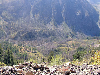 I stop and take a picture and start ahead only to see this at the next bend
 OK THIS is a serious road. Blind corners, drop off edges. It went on more than a 1/2 mile. Most of the way there were no pull off, and most of the pull offs were about the size of a Beetle. Thankfully going up and down I encountered no situation where I had a standoff with another vehicle.
Finally arriving I scoped out the surroundings. The wildflower meadows are pretty much done but look promising for next year
 The access road up to the top of Slate Peak is an easy stroll. It is just a half mile, not much as a hike goes. But the main attraction is for the view and for the wildflowers in season. Rare high elevation plants. The main hike along the foot of this ridge is 7 miles round trip so that makes the distance of the drive reasonable. There are ample camping and motel opportunities so it is going on my list for next year. Up here at 7100 ft ( 7480 at the top) you get a great view of many fine mountains
Mt Baker ( Koma Kulshan) 50 miles to the west
 Crater Basin (left) and Paul Bunyan's Stump (far right)
The Needles

The big reason I wanted to come here last weekend as the day three of my Rock and Road journey is the beach that is here
At 7100 feet the rock along the road is studded with sea snail fossils. This was once ocean floor.

While checking out some of the krumholtz and stonecrop plants I found ladybugs crawling everywhere. They were not the plump, slow, friendly ladybugs we all know. These were notably tiny and very busy. I did manage to capture this on on a lichen covered rock

Getting back to my car I chatted with a man who said the ladybugs would sometimes fly up in swarms.
It was a beautiful day and I am glad I made the trip. I had never been over Hwy 20 past Rainy Pass. I am looking forward to next year when the roads open again and this area will be at its best. Going home only took 4 hours. The advantage of a downhill drive!!!
No comments:
Post a Comment